
The modern era began at the turn of the century and continued through World War II, 1945. The years until 1929 are referred to as the Progressive Era. The Great Depression marked the end of this era.
Click on maps to link to source and zoom in on details.
Map of the Foreign-Born Population of the United States, 1900

Source: Henry Gannett in Statistical Atlas of the United States 1900. Available from History Now (The Gilder Lehrman Institute of American History).
Principal Routes of Transportation and Travel, 1901
![]()
Source: From Maury's Manual of Geography, Courtesy of Murray Hudson, Halls, Tennessee. Available from Alabama Maps, University of Alabama
__________________________________________________________________________________________________________________
Trails and Highways, 1919

Source: Modern School Supply Company. Available from Library of Congress, Geography and Map Division,in The Comprehensive Series, Historical-Geographical Maps of the United States
____________________________________________________________________________________________________________________
The United States in Commercial Relation to the World, 1919

Source: Modern School Supply Company. Available from Library of Congress, Geography and Map Division,in The Comprehensive Series, Historical-Geographical Maps of the United States
United States in the World War, 1919
Click to go to source and enlarge.

Source: Library of Congress, Geography and Map Division.
____________________________________________________________________________________________________________________
WRA Relocation Maps 1942-1946 (Japanese-Amerian Internment Camps)

Source: Japanese American Internment Camps
________________________________________________________________________________________________________________
Major POW camps across the United States as of June, 1944.

Source: U.S. Army. Available at Wikimedia Commons
U.S. Territories in 1900
Republic of Hawaii annexed 1898
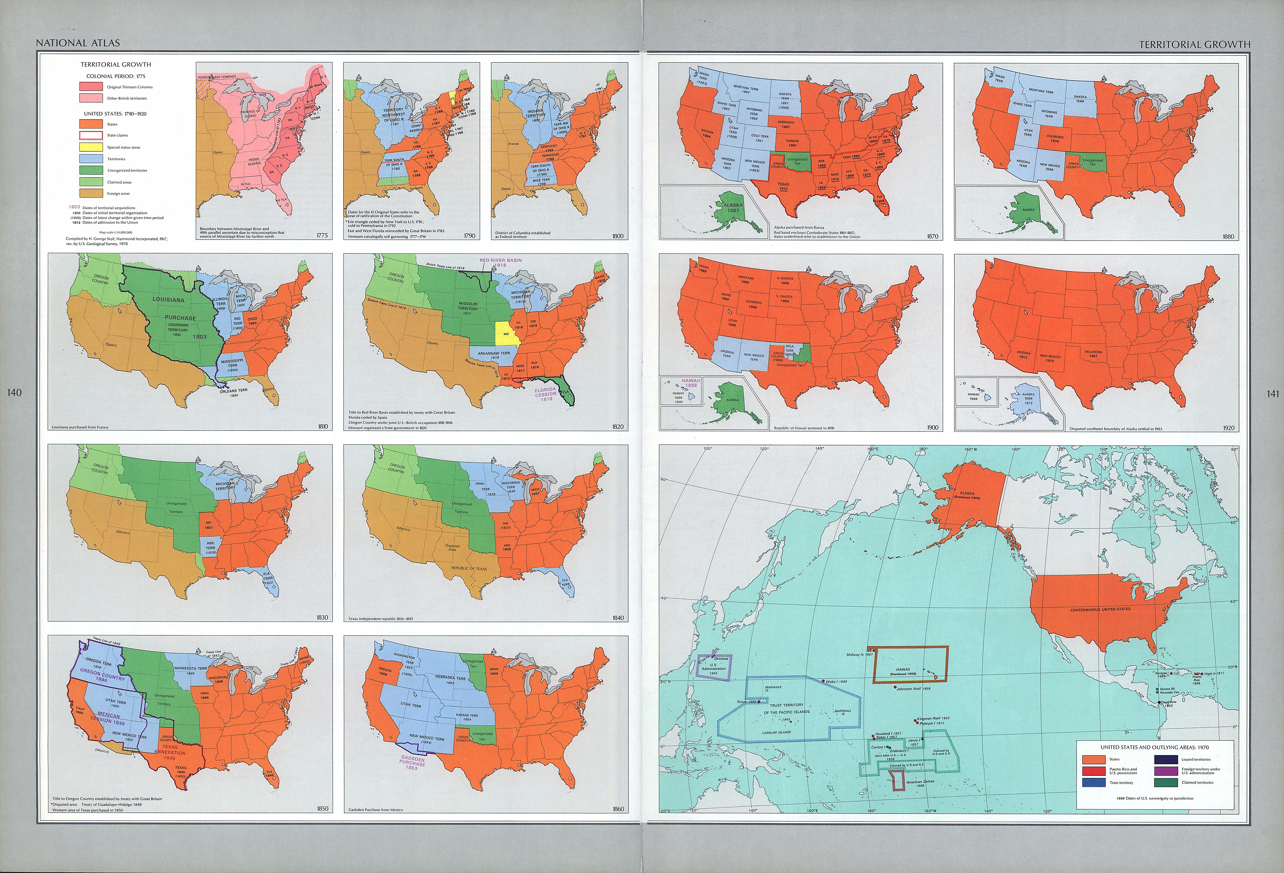
Source: National Atlas of the United States 1970. Available from Perry-Castañeda Library Map Collection - University of Texas
____________________________________________________________________________________________________________________
U.S. Territories in 1920
Disputed southeast boundary of Alaska settled in 1903
Source: National Atlas of the United States 1970. Available from Perry-Castañeda Library Map Collection - University of Texas
