The Western Frontier, or Western Expansion, era began with the Louisiana Purchase in 1803 and continued through the 19th century.until 1912 when Arizona was admitted to the United States as the 48th state. Opposing views during this time, on whether slavery should be allowed in the new territories became a major issue.
Click on maps to link to source and zoom in on details.
Following the Frontier Line, 1790 to 1890.
This series of maps highlights population expansion into new territory, subsequent gains in population density, and increasing urbanization.
Click on map below to connect to interactive features by dragging timeline.

Source: Decennial censuses 1790 to 1890. U.S. Census Infograhics & Visualizations.
____________________________________________________________________________________________________________________
Westward Expansion and Exploration 1803-1807
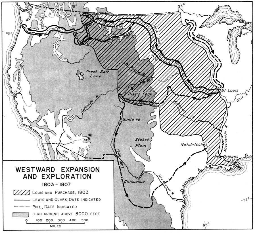
Source: From American Military History, United States Army Center of Military History, 1989 (194K) Available from Perry-Castañeda Library Map Collection, Historical Maps of the United States.
____________________________________________________________________________________________________________________
Westward Expansion 1815 -1845
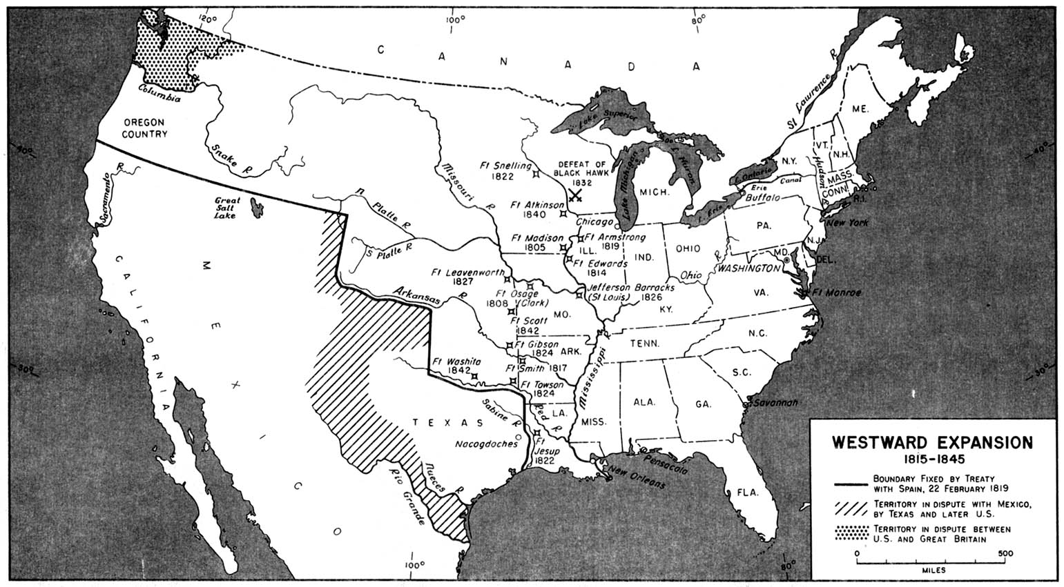
Source: From American Military History, United States Army Center of Military History, 1989 (258K). Available from Perry-Castañeda Library Map Collection.Historical Maps of the United States.
____________________________________________________________________________________________________________________________________________________________________________
A new map of Texas, Oregon and California - 1846

Source: Library of Congress Geography and Map Division Washington, D.C
Interactive time-lapse map of the taking of over 1.5 million acres of Native American lands by the United States between 1776 and 1887. Produced by University of Georgia historian Claudio Saunt to accompany his new book West of the Revolution: An Uncommon History of 1776, More details here as well as a link to the video, Invasion of America
Click on map below to see interactive features.

The Invasion of America is a project of eHistory.org.
Trails West
There were three main trails that most people took. They were the Mormon trail, Oregon trail, and Santa Fe trail.

Source:: From the Westward Expansion website
___________________________________________________________________________________________________________________
Line of Original Emigration to the Pacific Northwest Commonly Known as the Od Oregon Trail, 1843
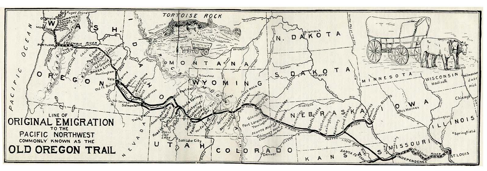
Source: from The Ox Team or the Old Oregon Trail 1852-1906 by Ezra Meeker. Fourth Edition 1907. Available from Perry-Castañeda Library Map Collection.
___________________________________________________________________________________________________________________
Santa Fe Trail
Travel the Trail: Map Timeline 1821-1845

Click on other timelines:
| Map Timeline 1846 - 1866 | Map Timeline 1866 - 1873 |
| Map Timeline 1873 - 1878 | Map Timeline 1878 - 1880 |
Source: National Parks Service, Travel the Trail: Map Timeline 1821 - 1880
____________________________________________________________________________________________________________________
1859 map of route from Sioux City, Iowa, through Nebraska, to gold fields of Wyoming, following old Mormon trails.

Source: Wikimedia Commons
Map of the Gold Regions of California, Showing the Routes via Chagres and Panama, Cape Horn, &c.- 1849

Source: David Rumsey Map Collection
____________________________________________________________________________________________________________________
Map of the Mining District of California,- 1850

Source: David Rumsey Map Collection
The Organization of Territories in the United States since 1803 (1803-1810, 1810-1835, 835-1855, since 1855)
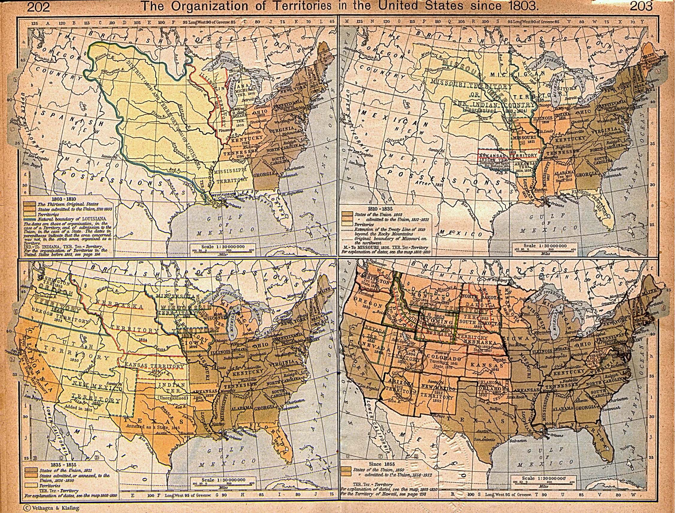
Source: From The Historical Atlas by William R. Shepherd, 1923.Available from Perry-Castañeda Library Map Collection
___________________________________________________________________________________________________________________
The United States, 1830
A map of the United States in 1830 showing the states and territories, the joint–occupation with Britain in Oregon Country, and the British and Spanish possessions at the time. The map shows the westward expansion of the United States, with the frontier line (heavy dashed line).

Source: Dixon Ryan Fox, Harper's Atlas of American History (New York, NY: Harper & Brothers Publishers , 1920) 38
Map Credit: Courtesy the private collection of Roy Winkelman. Available from Maps ETC.
____________________________________________________________________________________________________________________
Territorial Growth , 1776–1854. A map from 1890 of the United States showing the territorial expansion from the original Thirteen Colonies in 1776 to the territories prior to the Kansas–Nebraska Act of 1856.

Source: Dixon Ryan Fox, Harper's Atlas of American History (New York, NY: Harper & Brothers Publishers , 1920) 46
Map Credit: Courtesy the private collection of Roy Winkelman. Available from Maps ETC.
____________________________________________________________________________________________________________________
DeBow's 1854 Map of the United States.
In 1854, Superintendent J.D.B. DeBow produced, as part of his Statistical View of the United States (also known as the Compendium), the first map in a census publication. DeBow's map of the United States showed his delineation of the United States into four major regions, based on the major drainage systems of North America.

Source: U.S. Census Reference Maps, Population Distribution Over Time:
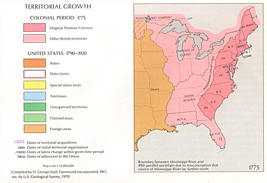
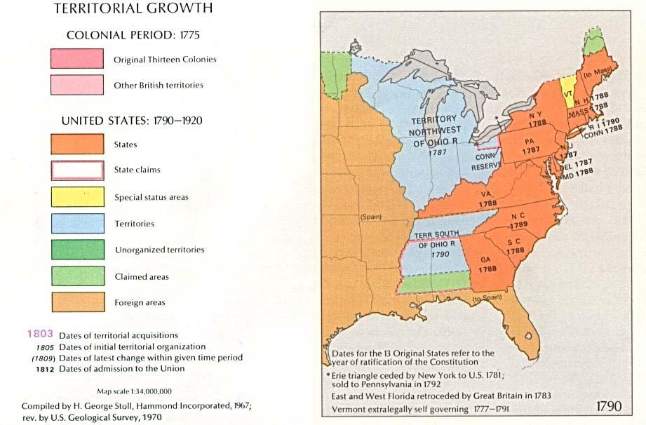
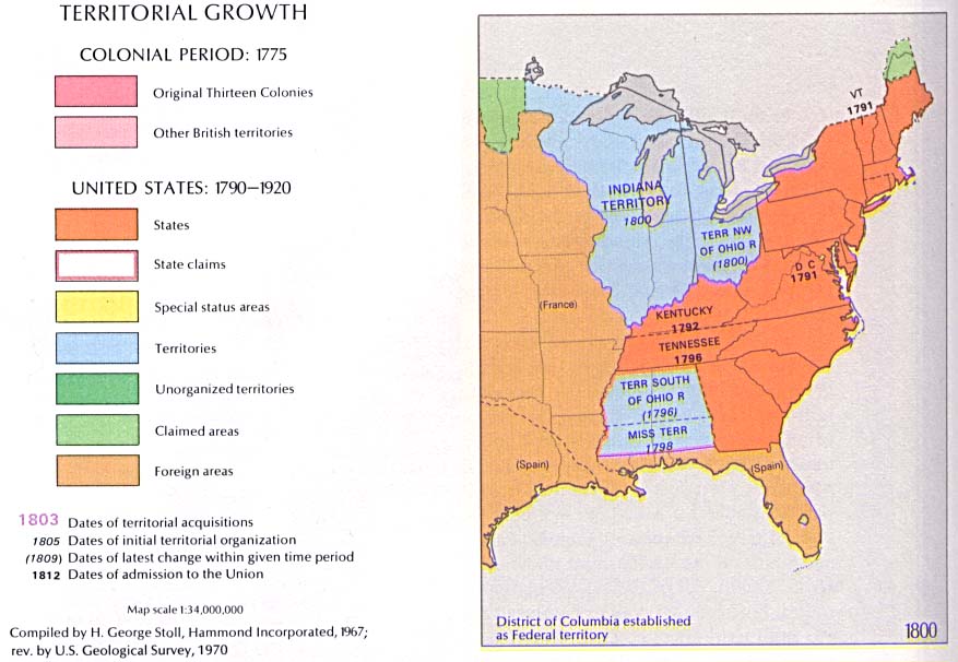
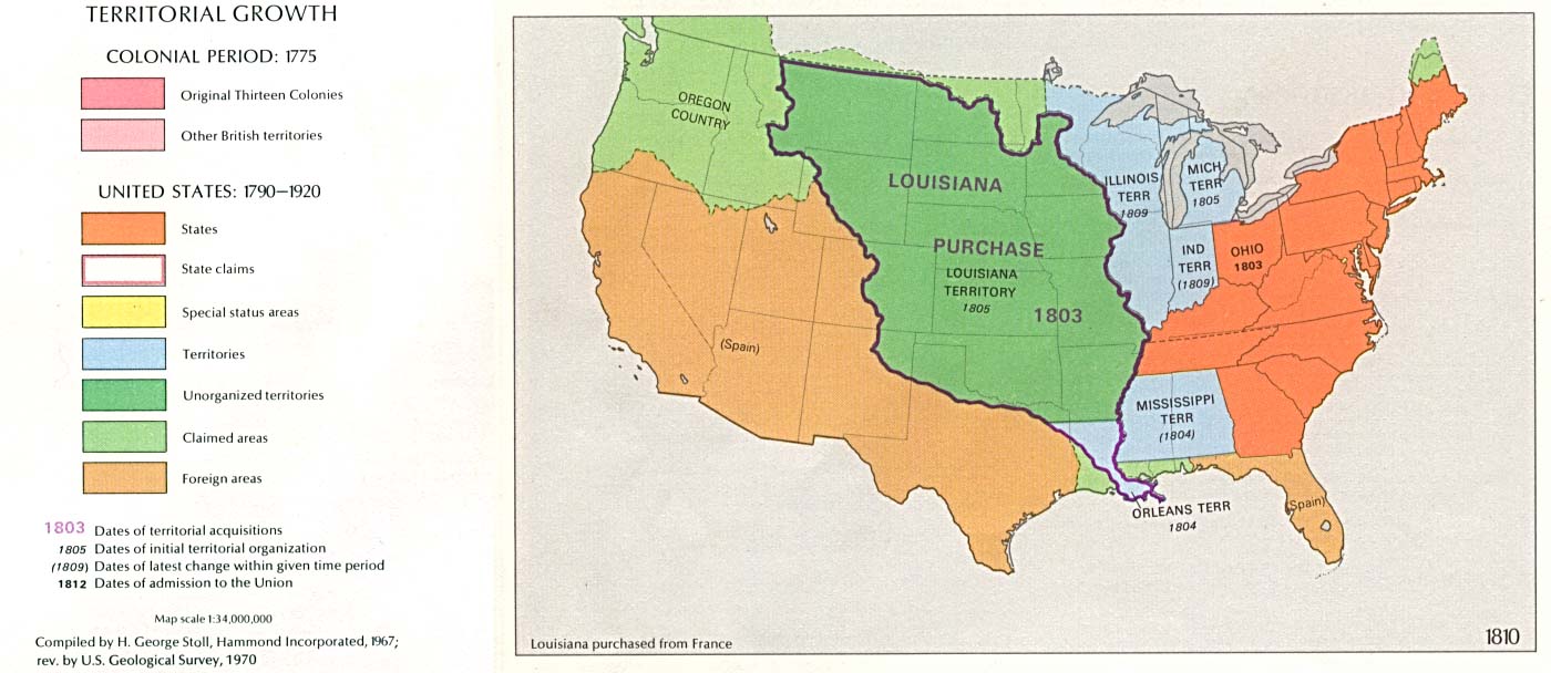
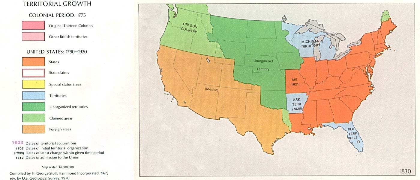
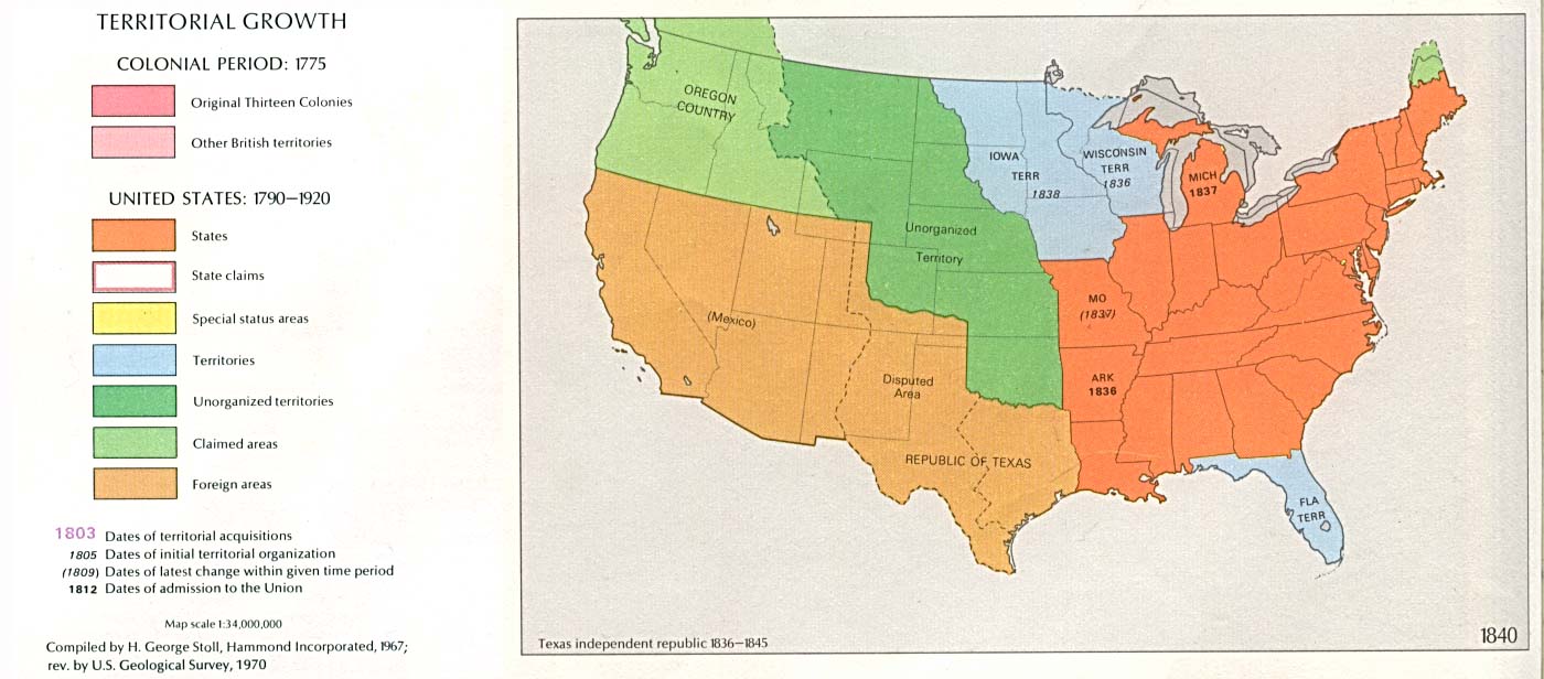
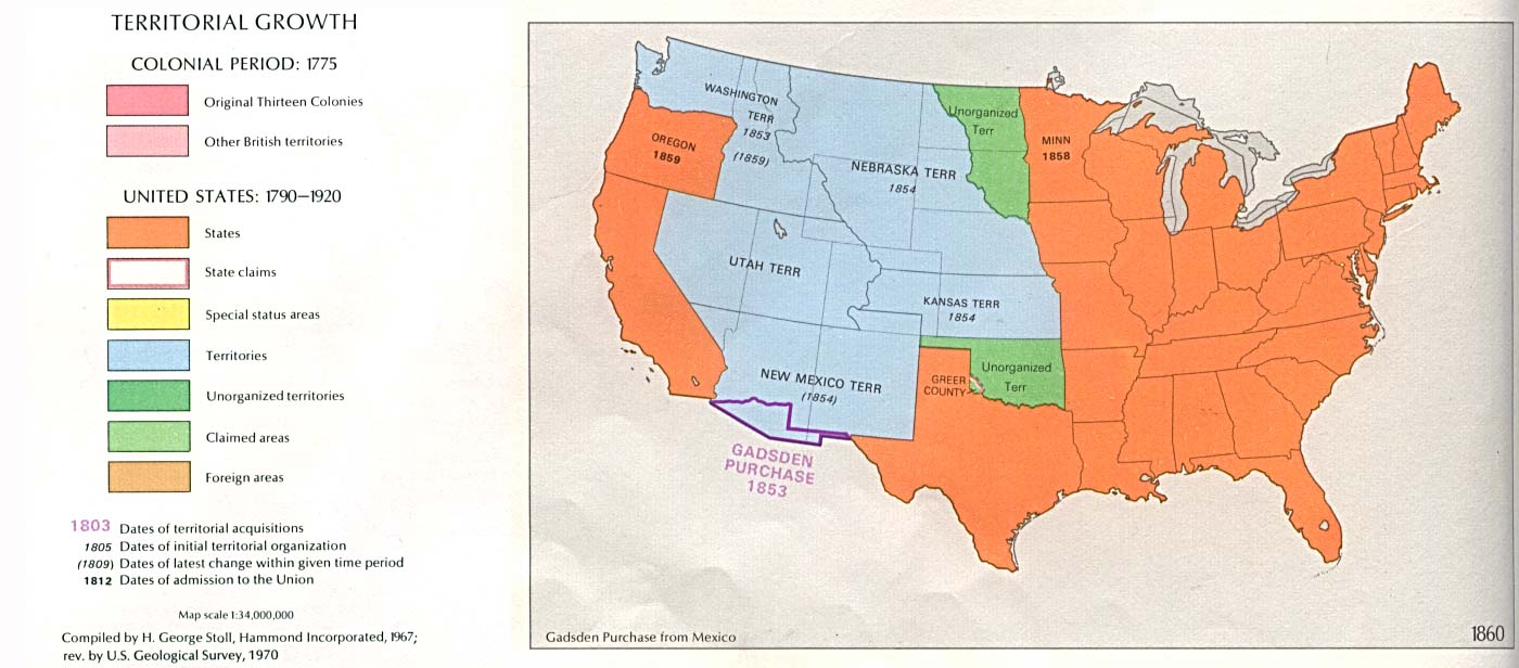
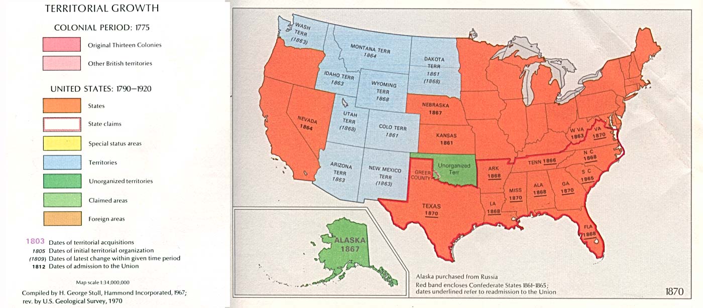
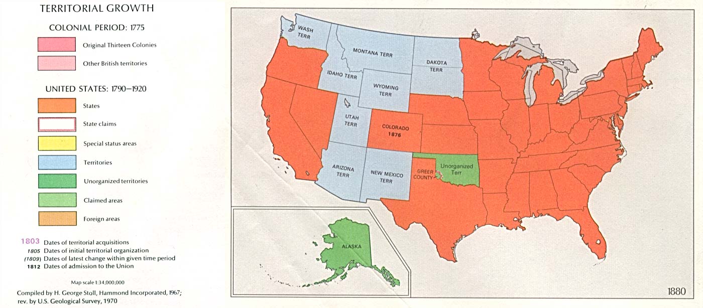
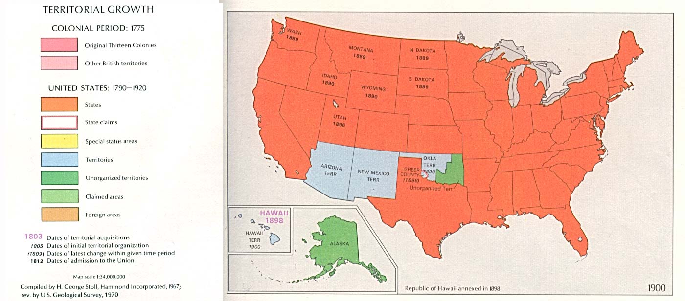
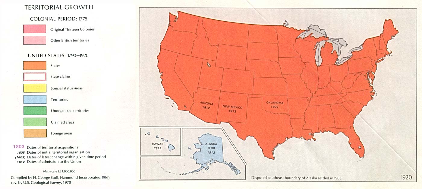
U.S. Territorial Growth Comparisons, 1775 - 1920 Click maps for larger view.
 |
1775
|
1790
|
1800
|
|
1810
|
1820
|
|
1830
|
1840
|
|
1850
|
1860
|
|
1870
|
1880
|
|
1900
|
1920
|
Source: The National Atlas of the United States of America (Arch C. Gerlach, editor). Washington, D.C.: U.S. Dept. of the Interior, Geological Survey, 1970 . Available from Perry-Castañeda Library Map Collection
The Spread of U.S. Slavery, 1790–1860. Click on map below to go to interactive map.

Source: Lincoln Mullen, "The Spread of U.S. Slavery, 1790--1860," interactive map, http://lincolnmullen.com/projects/slavery/,
doi: 10.5281/zenodo.9825.
__________________________________________________________________________________________________________________
The United States, 1821
A map of the United States in 1821 showing the states and territories which either accepted or abolished slavery after the Missouri Compromise of 1820. The map is color–coded to show absolutely free states, states undergoing gradual abolition, free by the Ordinance of 1787, territory free by the Missouri Compromise, and slave states and territories.

Source: Dixon Ryan Fox, Harper's Atlas of American History (New York, NY: Harper & Brothers Publishers , 1920) 37
Map Credit: Courtesy the private collection of Roy Winkelman. Available from Maps ETC.
____________________________________________________________________________________________________________________
Map depicting density of slavery in the USA in 1830.
Shows chief slave states as Virginia, Carolinas, Alabama, Georgia, Florida, Mississippi and Louisiana

Source: Map of slavery in USA 1830 / Lebrecht History / Bridgeman Images
__________________________________________________________________________________________________________________
Reynolds Political Map of the United States - 1856 based on 1850 census data. The map defined the nation by free or slave states and as territories open or closed to the expansion of slavery.

Source: United States Census website.